

Tuesday, January 7, 2014
VALLEY RAIN - HEAVY MOUNTAIN SNOW
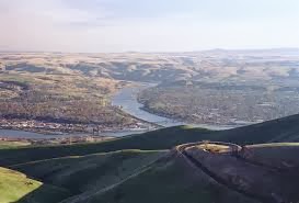
MORNING SNOW
CHECK THE RADAR: http://radar.weather.gov/radar.phprid=OTX&product=NCR&overlay=11101111&loop=yes
SNOW TODAY & TONIGHT
.jpg&container=blogger&gadget=a&rewriteMime=image%2F*)
Subscribe to:
Posts (Atom)
Most Popular Posts This Month
-
 Many are marking their calendars for a FANTASTIC even set for Sunday, January 20, 2019. In addition to being my baby girl’s 20th birthd...
 -
 I've heard this term (which makes me wince each time) quite a lot on news channels describing the "Blizzard of 2015". The fol...
 -
 by Michelle Crouch The Ghostbusters Dinosaur Scientists in Toronto identified a new species of dinosaur and named it Zuul, after th...
 -
Good News! The latest track maps from the National Hurricane Center steer the 3rd hurricane in as many weeks away from land. Giving the tro...
-
TIME PHASE 9:12 am Partial Eclipse begins – Moon touches Sun’s edge 10:27 am Max Eclipse – Moon is closest t...
-
 By Scott Sistek Published: Jul 7, 2015 It's been 36 days since Seattle has had a day considered below normal… ...
 -
 check out my workshop here - http://ow.ly/MFfz30jHHxH Weathering the Storm as a Notary Entrepreneur speaker bio: An award...
 -
 POOR AIR QUALITY continues to plague the Inland Northwest. We need a good breeze to scour the pollutants out of our valleys. This isn't...
 -
 In chronological order, here are 10 of the top weather stories of 2013 for eastern Washington and northern Idaho. L/C Valley June flood,...
 -
 Spokane, WA NWS The highlighted counties above are under a burn ban. This ban restricts the use of outside burning and the use of unapprove...


.jpg)