click link above for photo series of storm development
http://www.komonews.com/weather/blogs/scott/Photos-Majestic-thunderstorm--269084221.html
Weather, info & pics of the Lewis/Clark Valley (Lewiston, Idaho/Clarkston, Washington) and the Inland NW
Thursday, July 31, 2014
Why Seattle doesn't see Eastern Wash. wildfire plumes until the afternoon
By Scott Sistek Published: Jul 30, 2014
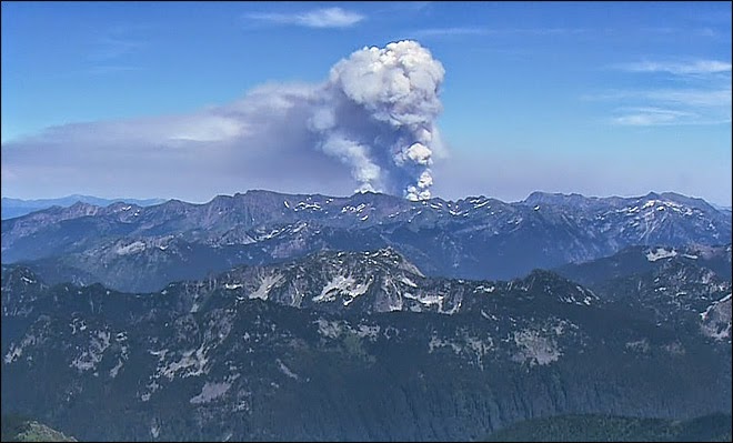
Local social media posts have been perking up each afternoon noting tall plumes of clouds over the Cascades. What you're seeing are smoke and the "pyrocumulus" clouds created by the wildfires burning in Eastern Washington. The heat from the fires is its own engine for creating rising air that cools and condenses into clouds.
But why don't we normally see those clouds over here until the afternoon?
There is a bit of an inversion in play in Eastern Washington, caused by sinking air aloft from high pressure and cooler air forming near the ground at night from clear skies allowing the day's heat to radiate back into space.
The morning weather balloon launched in Spokane Wednesday showed the temperature at the surface was 63 but was a whopping 84 degrees at 3,000 feet. It was a little warmer in Central Washington near the wildfires this morning, but you get the idea. Wildfire Plume over Eastern Washington
But as the day -- and the ground -- warms up, eventually this process reverses and the lid goes 'poof' allowing the hot air and smoke to roar to the skies, creating a vertical plume visible across much of the state.
amazing video of wildfire smoke movement http://www.komonews.com/weather/blogs/scott
Subscribe to:
Posts (Atom)
Most Popular Posts This Month
-
By Carol Zinke Published: Dec 26, 2014 LEWISTON, ID - Hope you had a joyous Christmas. As the excitement is winding down from the hol...
-
by Michelle Crouch The Ghostbusters Dinosaur Scientists in Toronto identified a new species of dinosaur and named it Zuul, after th...
-
Good News! The latest track maps from the National Hurricane Center steer the 3rd hurricane in as many weeks away from land. Giving the tro...
-
TIME PHASE 9:12 am Partial Eclipse begins – Moon touches Sun’s edge 10:27 am Max Eclipse – Moon is closest t...
-
check out my workshop here - http://ow.ly/MFfz30jHHxH Weathering the Storm as a Notary Entrepreneur speaker bio: An award...
-
Vast underwater Roman ruins have been discovered off northeast Tunisia, apparently confirming a theory that the city of Neapolis was partly ...
-
Unless you're a pagan and you plan to do some dancing and drinking at the famous Stonehenge monument in England, you probably won'...
-
WSDOT plans a celebration of the old and new Feb. 2-3 Mike Lindblom Seattle Times Reporter Check out the demolition to Seattle'...
-
In chronological order, here are 10 of the top weather stories of 2013 for eastern Washington and northern Idaho. L/C Valley June flood,...